NewsUpdate
We renewed the DroMap screen: a larger map, weather at a glance, and the new Measure feature
We renewed the map screen on desktop and smartphone. The map now fills the screen, weather and wind are visible at a glance, and a new Measure (distance measurement) feature lets you measure the distance between points on the map.
Contents
Thank you for using DroMap. On October 28, 2026, we renewed the map screen on both desktop and smartphone. The new layout shows more of the map, and a new Measure (distance measurement) feature is now available. This article walks through what changed and how to use the new screen.
What is new in this update
Search and tools now sit along the edges of the screen, so you can see more of the map.
The map shows the weather, temperature, and maximum wind speed for the spot you are looking at.
Measure the distance between points you pick on the map, right away.
01The new screen layout
The features you use most are now gathered along the edges of the screen, which gives the map more room. Here is how to read the screen on desktop and on smartphone.
Desktop
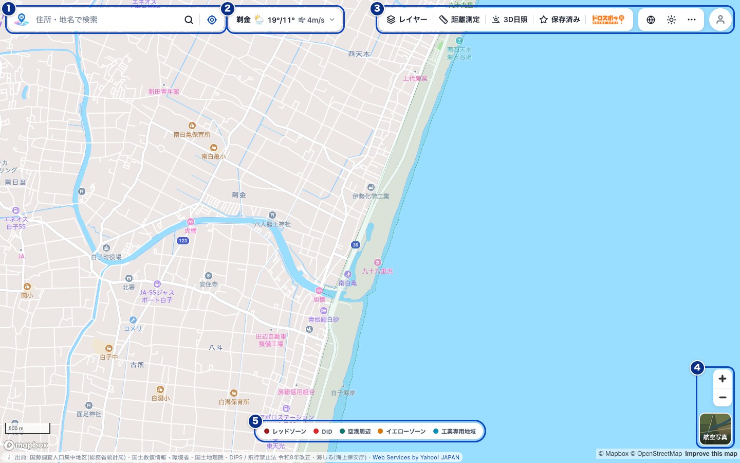
- Search box: Look up a place by address or place name. The button at the right end checks your current location.
- Weather: Shows the weather and maximum wind speed near the center of the map (details in the next section).
- Toolbar: Switch Layers, Measure, 3D sun, Saved, and DroSpot! on and off. The buttons on the right let you change the language or appearance, and log in.
- Zoom and map type: Zoom in and out, and switch between the standard map and satellite view.
- Legend: The areas that the map colors stand for (Red Zone, DID, Near airport, Yellow Zone, Exclusive Industrial Zone). Hover over an item to see what the area means. Click it to open the list of layers, where you can turn each layer on or off.
The check result for a point you click on the map, and the Saved list, appear below the search box.
Smartphone
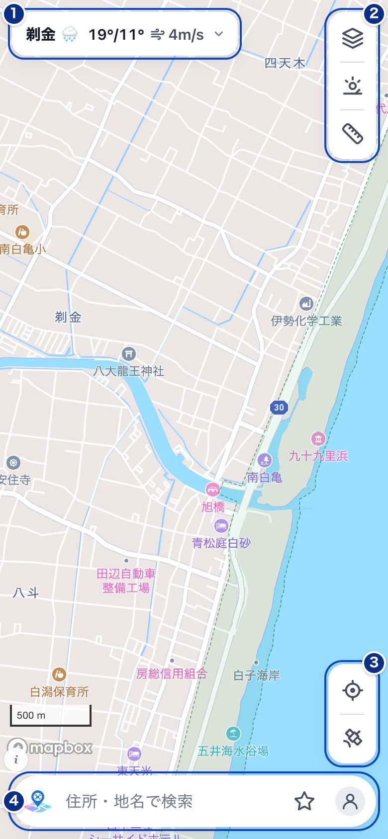
- Weather: Shows the weather and maximum wind speed near the center of the map. Tap it to open the forecast.
- Layers, 3D sun, Measure: From top to bottom, the buttons for the layer list, 3D sun, and Measure.
- My location and map type: The upper button checks your current location. The lower button switches between the standard map and satellite view.
- Search box: Look up a place by address or place name. The star at the right end opens your Saved list, and the person icon opens the account menu.
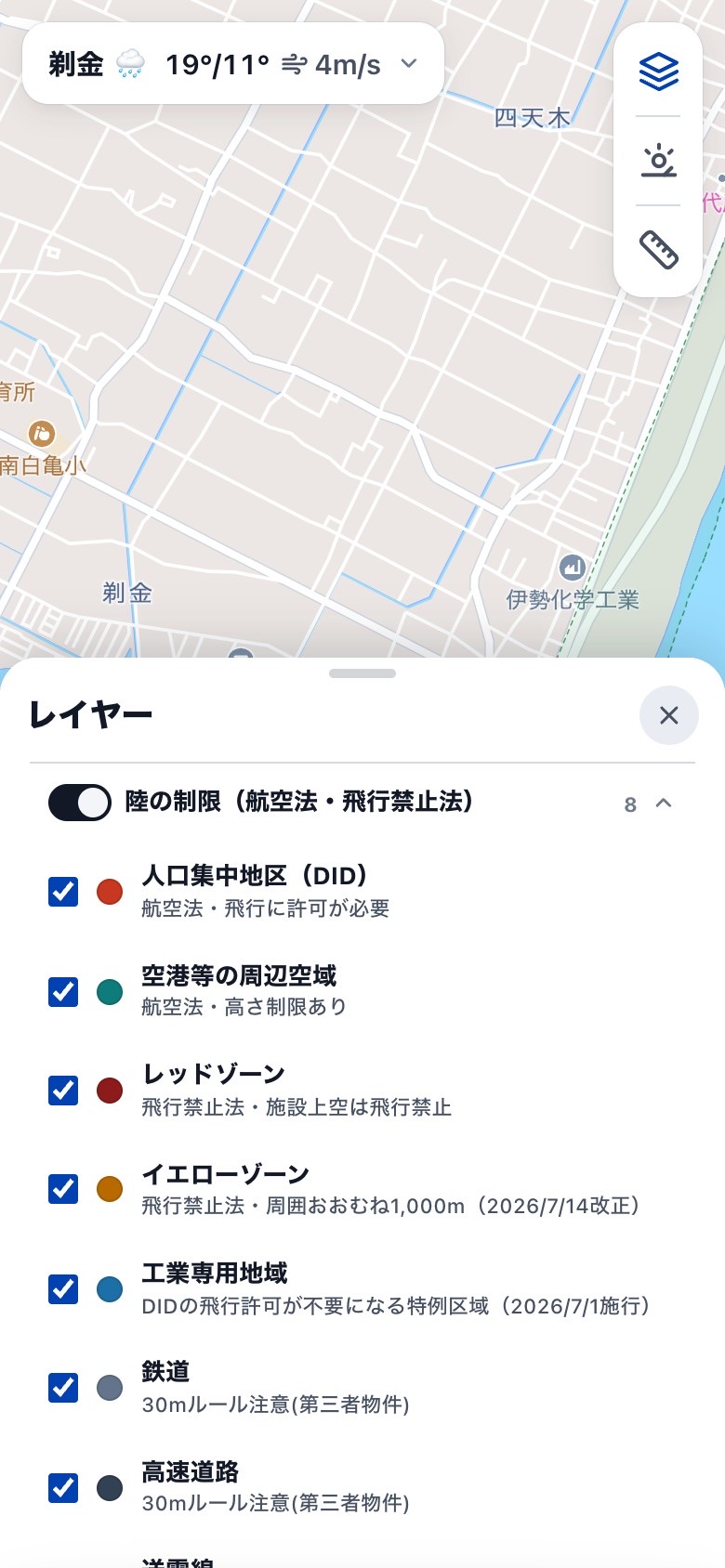
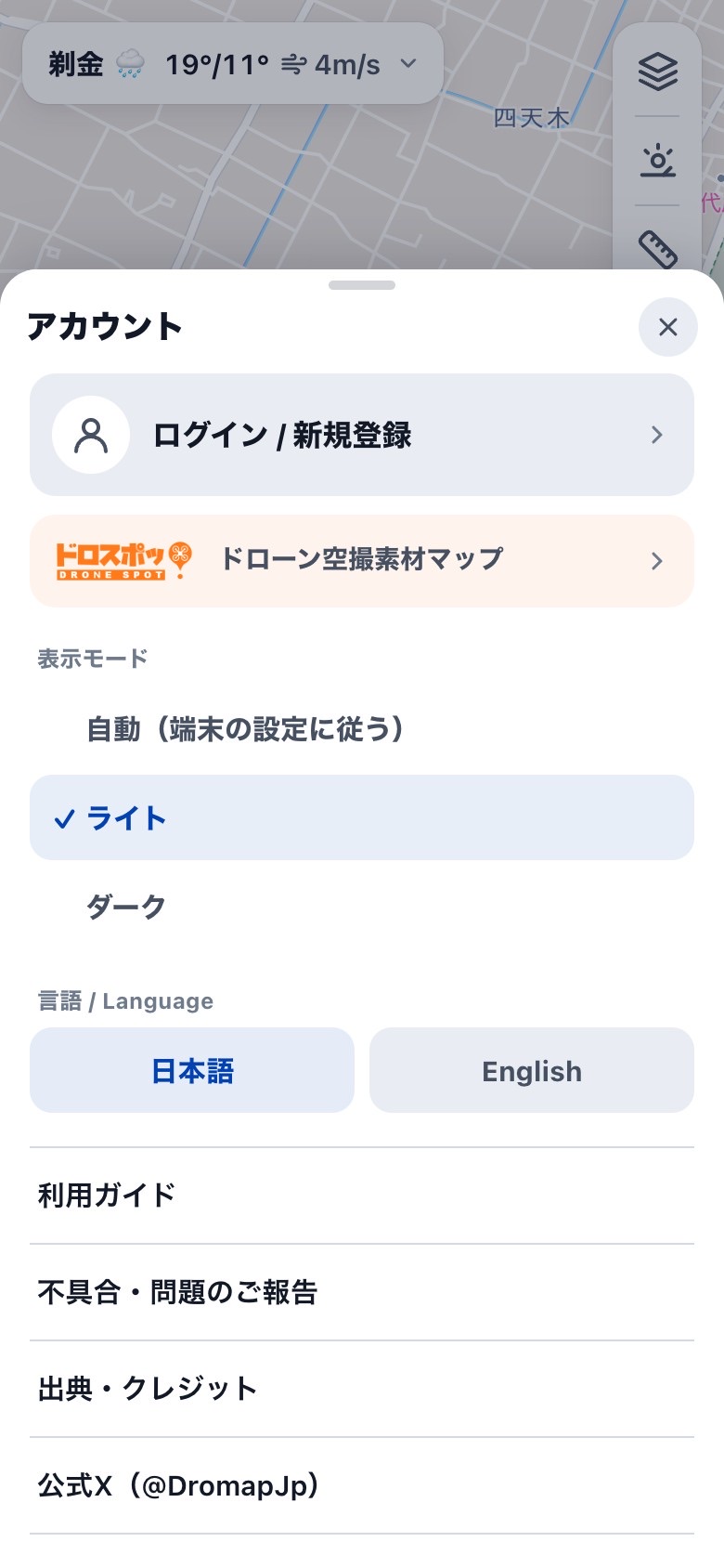
The Layers and Saved lists open in the lower half of the screen. Swipe up to expand them to full screen. Swipe down to return to half height, and swipe down once more to close. From the account menu you can log in, change the appearance (light or dark) and the language, and open DroSpot! (the drone aerial footage map).
02Check weather and wind while you look at the map
To the right of the search box on desktop, and at the top left of the screen on a smartphone, the map shows the name of the place near its center, along with the day's weather, high and low temperatures, and maximum wind speed. When you move the map, the display updates automatically.
Click it (tap it on a smartphone) to open the sunrise and sunset times and the weather and wind forecast. Maximum wind speeds of 5 m/s or more are shown in orange, and 8 m/s or more in red, so use them as a guide when you choose a flight day.
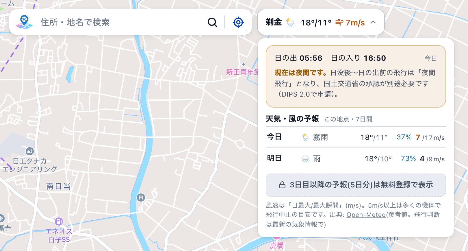
The forecast from day 3 onward (5 more days) is shown after a free sign-up. When the map is zoomed out to a wide area, such as all of Japan, no weather is shown.
03How to use the new Measure feature
Measure shows the distance between points you pick on the map, right away. It takes three steps.
On desktop
- Click Measure in the toolbarThe button turns blue, and you are ready to measure.
- Click the points you want to measure, one after anotherA line connects the points, and the distance of each segment appears on the line.
- Double-click the last point to finishThe total distance appears at the end point.
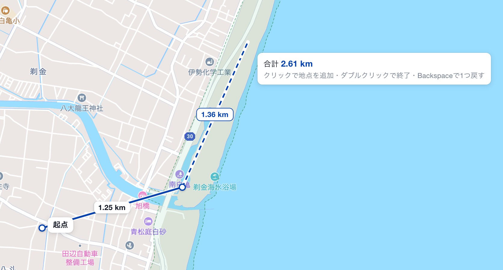
On smartphone
- Tap the ruler button at the top rightThe button changes color, and you are ready to measure.
- Tap the points you want to measure, one after anotherA line connects the points, and the distance of each segment appears on the line.
- Tap the last point again to finishThe total distance appears at the end point. You can also finish by tapping the ruler button again.
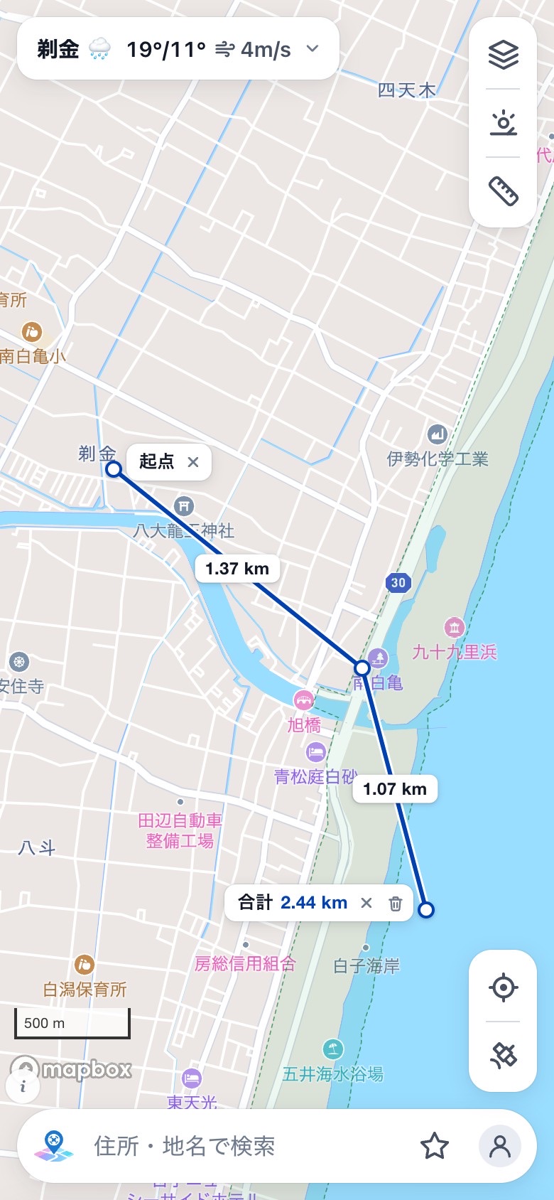
Handy tips
- You can move a point you placed by pressing and dragging it. Points on a finished line can be moved too.
- A line you measured stays on the map. To delete the whole line, use the trash icon next to Total. To delete only the start or end point, press the "×" next to Start or Total.
- On desktop, press Backspace to undo the last point you placed. You can also finish measuring with a right-click or the Esc key.
When this is useful
- To check how far it is from your takeoff spot to the place you want to shoot
- To get a rough idea of the length of a flight route
- To estimate the distance to nearby buildings, roads, and other objects
The distance shown is the shortest distance along the ground between two points (a straight line). It does not include differences in height.
Supported environments
The new screen is available on desktop and other environments with a screen width of 900 px or more, and on smartphones in portrait orientation. On other screens, such as a tablet in portrait orientation or a smartphone in landscape orientation, you will see the same screen as before.
We will keep working to make DroMap easier to use. Send your feedback and requests through the contact form.
Check results, weather, and distances are for reference only. Before you fly, always confirm with official sources such as DIPS 2.0 (MLIT's online drone application system).
This is an English translation of the Japanese original. If the two versions differ, the Japanese version prevails.
More news
- NoticePlease update the iPhone app (from Nov 24, version 1.3.2 and earlier can no longer check locations)
- ExplainerBefore your first drone flight in Japan: register the drone first
- ExplainerMLIT amends its Review Guidelines, clarifying how routes over DIDs and similar areas are handled in BVLOS flight without visual observers